|
January 4、1999: Oita River Bank Walking (Part 3); From Funai Bridge to the river mouth. | |
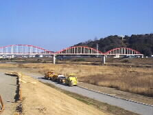 |
The trail in the riverbed is interrupted at the down stream of Funai Bridge. It is now under construction. We climbed up to the bank to trace the bicycle road. A red water-bridge crosses the river. |
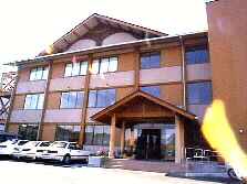 |
An unusual building. This is "Oita Forestry Hall," filled with the fragrance of wood. It was built a year ago. |
 |
Hirose Bridge is relatively new connecting Route 10 to Shimogouri Industrial Complex. The parapet of the bridge is decorated with the castings of camellia (the symbol flower of Oita prefecture) and motive of old foreign sailing ships that arrived Oita port in Edo period. Sourin Otomo, then feudal lord of Oita, encouraged the trading with western countries. |
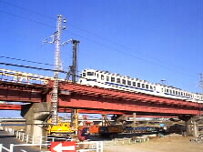 |
A train runs over the railroad bridge of Nippo line. Just behind the bridge is Takio Bridge. |
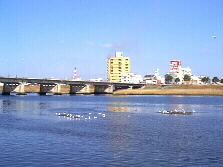 |
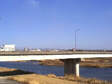
After passing under the Takio Bridge, the Oita River suddenly becomes wide. Many seagulls replaced ducks and are drifting on the water. Here, fresh water mixes with seawater. This is Maizuru Bridge. Route 197 runs on it. On the left is downtown Oita including the district where the government offices are located. |
  Far away is Benten Bridge, the last one on the Oita River. The sea is near already. There is a waterfront park between Takio Bridge and Benten Bridge. Many events are held here, such as Hina doll drifting in spring and fireworks in summer. A family is canoeing slowly in the river.
| |
 |
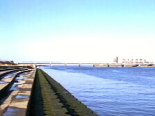
On the other bank of the river downstream of Benten Bridge is a hovercraft terminal. A craft has just arrived from Oita air port, soon landing on the dry port. Behind the terminal are Oita Industrial Zones that include giant companies like Nippon Steel, Kyushu Power Station, Showa Chemicals, and Sumitomo Chemicals. |
 |
A temporary heliport in the dry riverbed. |
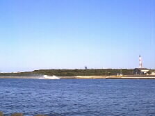
 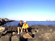 Finally, we arrived at the end-point of the trail. Beyond the concrete pavement, many tetra-pots are roughly piled up. The Beppu Bay opens behind us widely. Kunisaki peninsula is faintly visible far away. On the right are unloaders in a steel plant. We walked for 15 kilometers in three hours. We did it!
| |
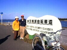 |
This is the sign of the trail. It reads "Benten-Yokose cycling Road." A kind female took a picture for us. |
 |
We went back to Takio Bridge from which I take a bus to home. My husband Ken rides back on the bicycle. |
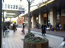  I walked to the center of the downtown to take a bus to hometown. This is the most crowded bus center that serves for local and long-distance lines. A bus is just to start for Fukuoka City. All the seats seemed to be filled with passengers who return to business or back to school after short holidays in Oita.
| |
| I returned home as the dusk gathers, few minutes after five p.m. I found the bicycle in the garage already locked to the pillar. My husband said it took just 45 minutes back to home. When he arrived at home, I was still waiting for the bus. I was surprised to find that how fast one can move through the cycling road along the river. Today, I saw many popular things from new angles. I fully enjoyed today and made up my mind to ride a bicycle much more than ever to create a healthy life. | |
Mie Home
Topicks