| |
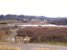
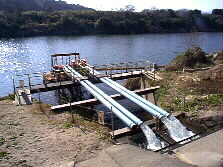  We enjoyed a healthy walking on the comfortable open trail in the dry riverbed. Some bicycles run on the bank above. A water take-in (left) supplies drinking water to a tank (right) in Enokuma water filtration plant. The facility is permitted to run until 1993. | |
 |
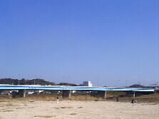
Oita highway runs over the Oita River. |
 |
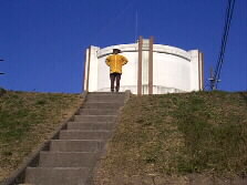
A water gate will protect Oita City from flooding. |
 |
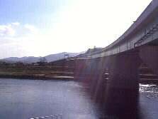
Route 210 crosses the Oita River before heading to Yufuin and Hita. The bridge is called "Akegawara Bridge." We usually pass the bridge by a car or bus that takes me to downtown Oita. The bridge consists of two passes, exclusive up and down lanes. |
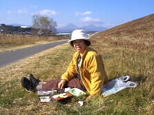 |
We are hungry by walking up to here. We left home at 10:30 a.m., and it is already after noon. We bought some foods at a nearby super market and took lunch on the grass. They were very tasty. |
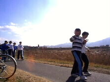 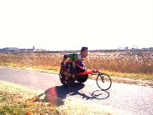 Female middle school students are passing by in front of us, making V-signs and smiling. A wheelchair runner also flew away very fast before we knew.
| |
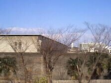 |
After taking lunch, we climbed the slope and saw a high long wall of Oita prison. A white building in the distance is Oita prefectural hospital. |
 |
Another stream called Nanase joins to the Oita River here. |
 |
We are now refreshed and continued walking or riding bicycle down to the river mouth. Route 10 runs on Funai Bridge. A family was enjoying flying a kite on the play ground under the bridge. The distance from Kaku Bridge to Funai Bridge is about 6.4 kilometers. We have already walked 11.4 kilometers from home. |
to Part 3